Mid-Level Projects
This is a small selection of the mid-level projects that InfraVis has conducted
-
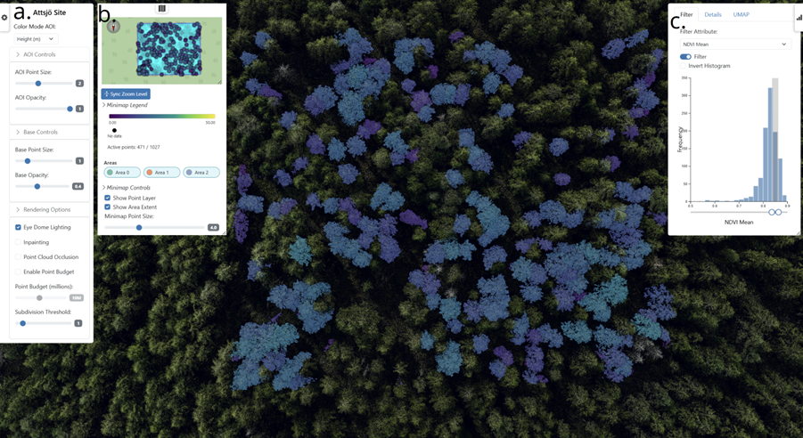
ForestVis: Visualizing Individual Tree Characteristics in Forest 3D Point Clouds Using Remote Sensing Data
ForestVis is a web-based 3D visualization system for the interactive visual exploration of forest data.
-
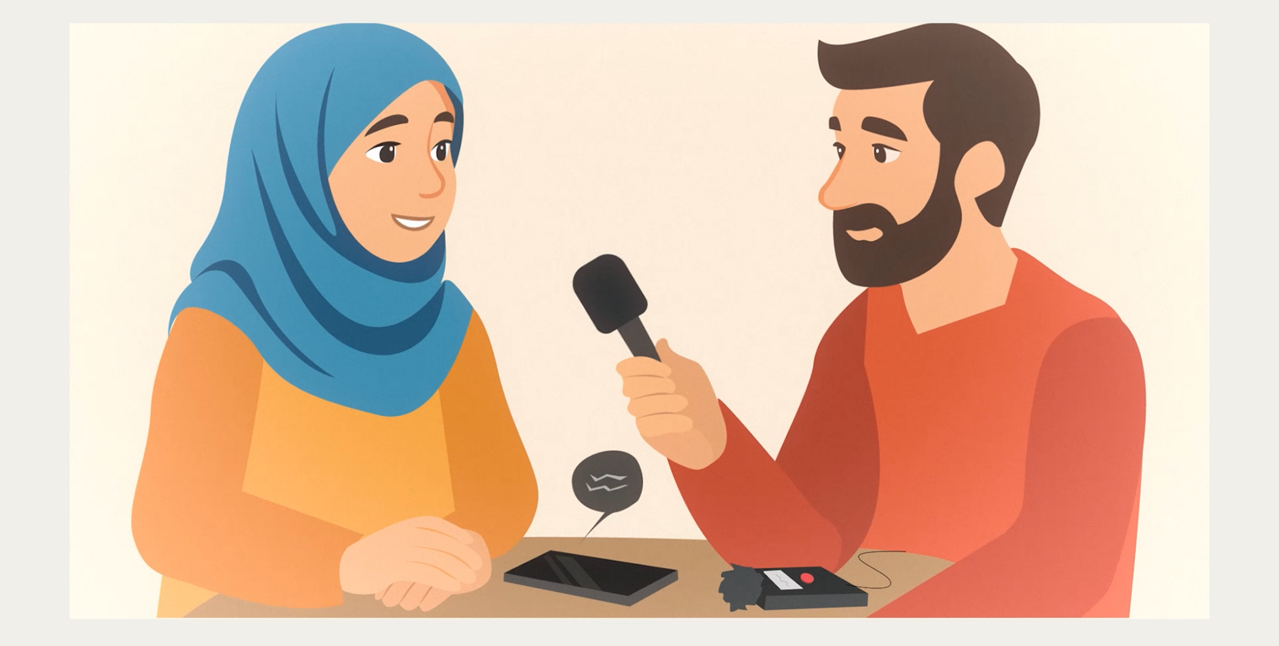
Consent forms for people with limited previous education
In this project, simple, multilingual videos were created to help refugees better understand and give informed consent to research participation.
-
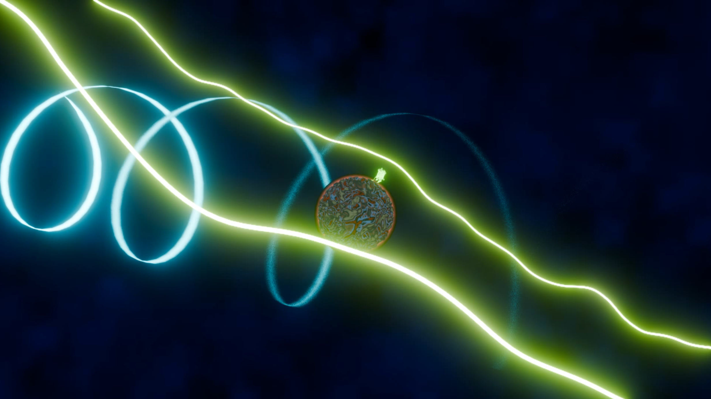
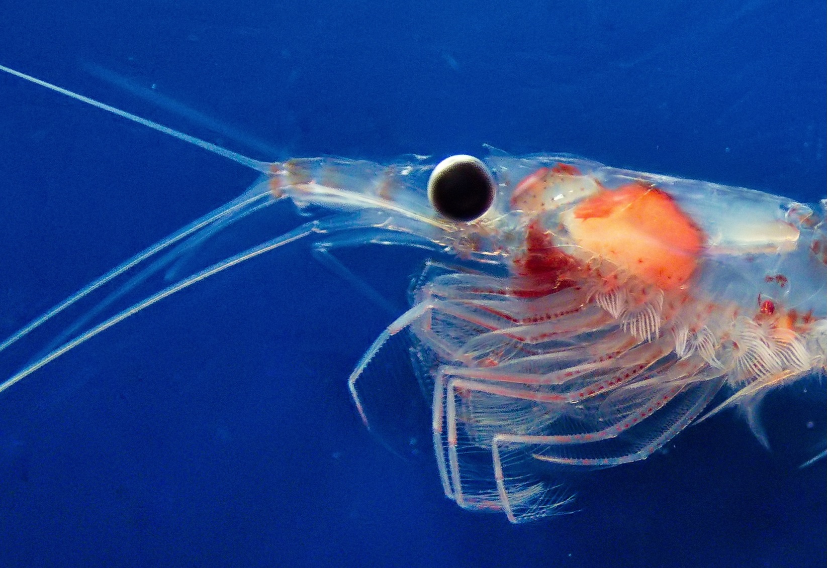
Visualizing physical interactions of molecules in macromolecular scale
The research group led by Ilaria Testa (KTH, SciLife Lab) has developed a novel method for measuring the rotation of molecules in a solution.
-
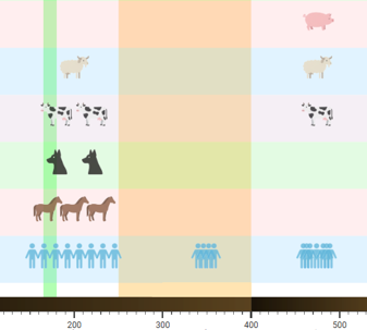
Human Timeline
Human-Timeline is an interactive React and PlotlyJS application that visualizes the coevolution of human culture , diverse life species and environmental factors across vast timescales. Inspired by SIMILE’s TimePlot and TimeLine patterns, it combines stacked timelines with dual-axis plots so users can see discrete events, continuous measurements, and contextual periods in one place.
-
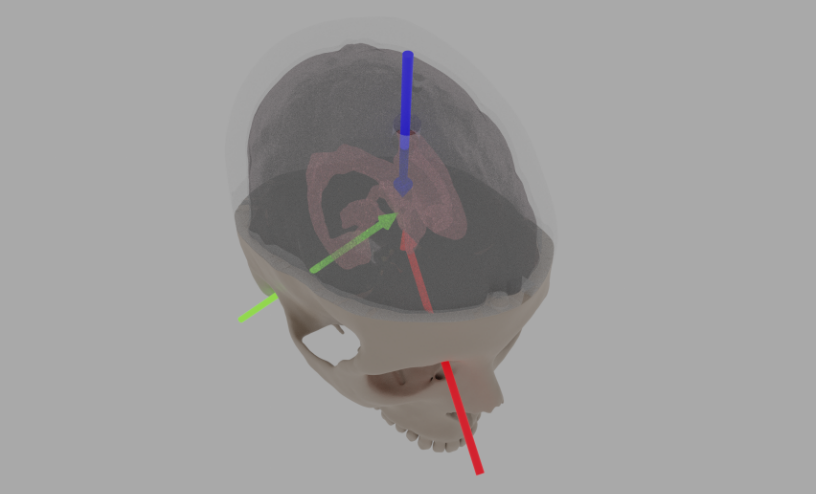
3D Modeling for simulated ventricular surgery
Brain surgery requires extreme precision, which makes realistic training essential. This project was created to improve practice conditions for a procedure where a catheter is inserted into the brain’s ventricles to relieve fluid buildup. The training setup uses a 3D‑printed skull and a Jello‑based artificial brain that mimics real tissue. InfraVis contributed by redesigning and…
-
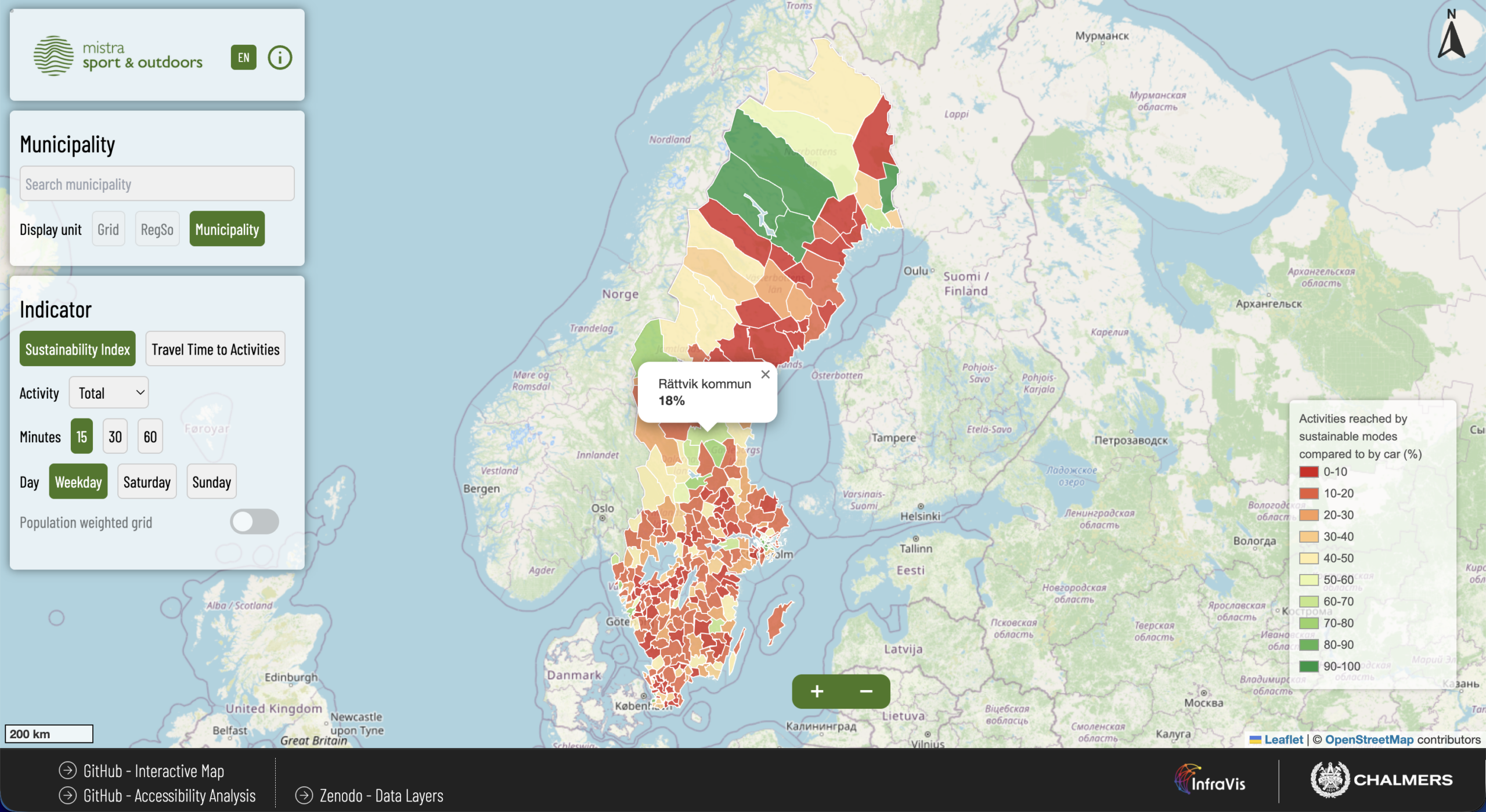
Sport and Outdoors Sustainable Accessibility Map
Welcome to the Sport and Outdoors Sustainable Accessibility Map – an innovative tool designed to explore, help understand and improve sustainable accessibility to sports and outdoor activities throughout Sweden.
-
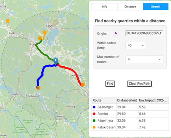
GIS Benchmark Tool for Environmental Impact of Quarries and Mining Industry
QuarryGIS is an interactive environmental visualization and benchmarking tool built to make quarry and construction sector impacts tangible for producers, clients, and planners.
-
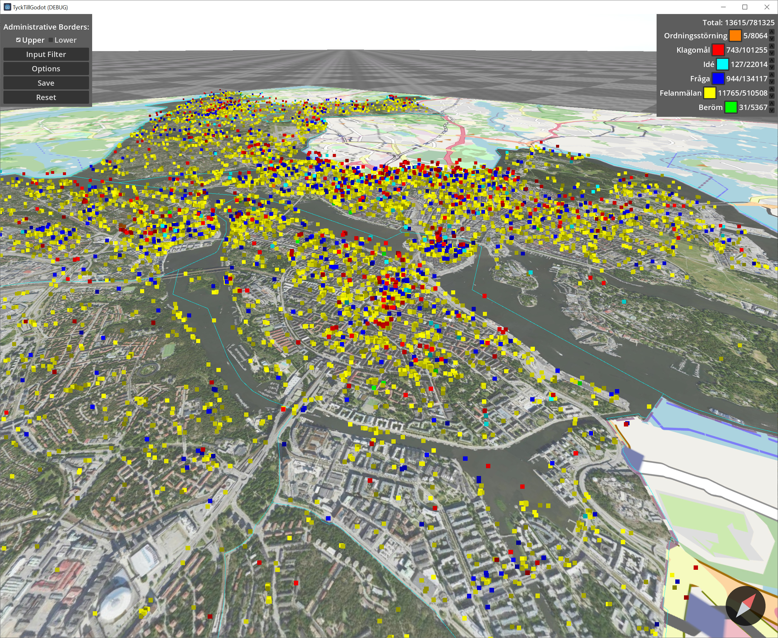
Interactive visualization of crowd sourced urban data from Tyck Till
This project focused on crowd sourced urban data collected from Tyck Till an app developed by Stockholms Stad where users can leave feedback and report errors in the city. The data contains approximately 800 000 georeferenced reports in various categories. The goal of this project was to facilitate interactive exploration of this data through filtering and…
-
GenomeLens
The aim of the project is to produce the novel interactive tool “GenomeLens”, that uses genome sequencing data to visualize genetic variation along chromosomes within and between populations.
-
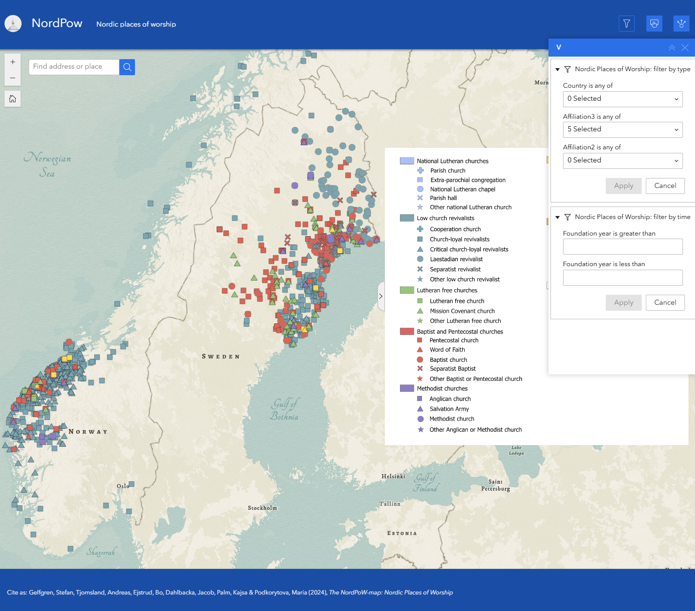
NordPow
The project’s primary objective is to create a comprehensive Nordic resource for researching churches and prayer houses. At the same time, it seeks to document and preserve the rich historical heritage associated with these religious sites across the Nordic region. The primary audience for this initiative is researchers specializing in religious studies. Currently, the dataset…