Maria Podkorytova
Umeå University
Geographer
Role In Infravis
Application Expert
Experienced In
Cartography, GIS, Networks
Tools Used Frequently
ArcGIS, QGIS, Gephi, MATLAB
About
I am an application expert at the InfraVis.
Project for InfraVis
-
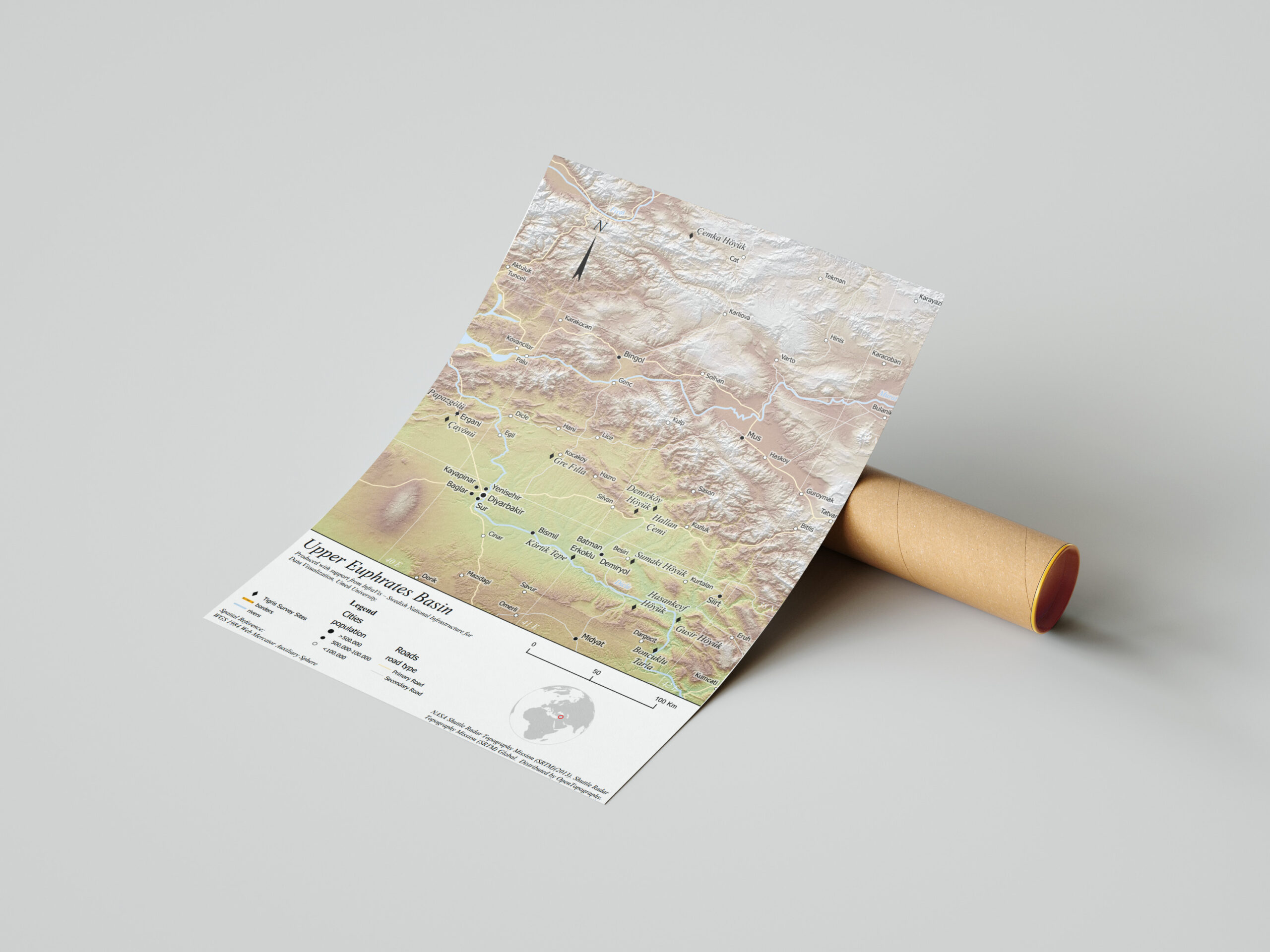
GIS visualization of archaeological sites in the upper Tigris and Euphrates River basins
The project produced GIS-based maps and diagrams to visualize archaeological sites and material culture, highlighting the regional shift from hunting-gathering to farming. It integrates environmental and archaeological data to show patterns of human–environment interaction across multiple case study areas and their chronological development.
-
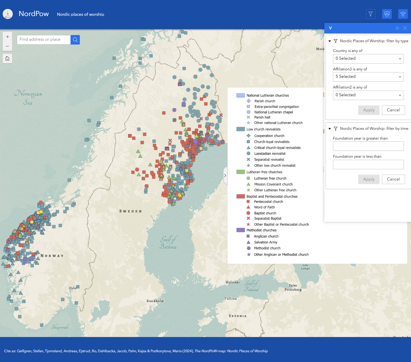
NordPow
The project’s primary objective is to create a comprehensive Nordic resource for researching churches and prayer houses. At the same time, it seeks to document and preserve the rich historical heritage associated with these religious sites across the Nordic region. The primary audience for this initiative is researchers specializing in religious studies. Currently, the dataset…