Sport and Outdoors Sustainable Accessibility Map
Author: Kristin Åkerlund, 2026-01-27
InfraVis User
Jorge Gil
InfraVis Application Experts
Kristin Åkerlund
Tristan Bridge
Funding
The Swedish Foundation for Strategic Environmental Research, Mistra + partners (including participating universities)
InfraVis Node Coordinator
Fabio Latino
Open Data
Partially open data
Background
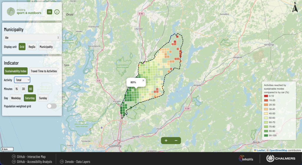
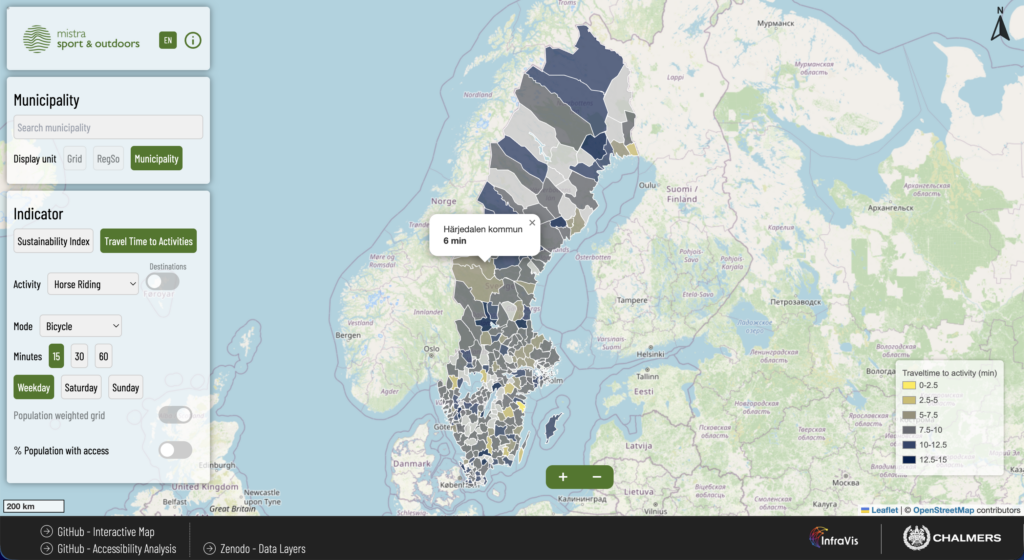
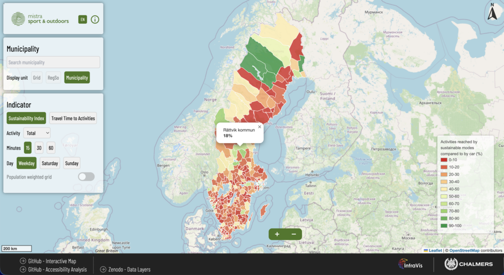
Welcome to the Sport and Outdoors Sustainable Accessibility Map – an innovative tool designed to explore, help understand and improve sustainable accessibility to sports and outdoor activities throughout Sweden. This tool offers an intuitive interactive map that visualizes accessibility at national and municipal scales, empowering individuals, policymakers, and organizations to make informed decisions.
With this tool you can visualize how the population can access different sports and outdoors activities using different transport modes, including walking, cycling, driving and by public transport.