Digital Twin Lab
InfraVis User
Anders Logg (Chalmers)
InfraVis Application Expert
Vasilis Naserentin (Chalmers)
Orfeas Eleutheriou (Chalmers)
InfraVis Node Coordinator
Fabio Latino (Chalmers)
Data
Open
Tools & Skills
UI/UX, software development, 3D printing
Funding
Co-funded by DTCC (Vinnova Grant 2024-03904) and InfraVis L3 ticket “Bringing the City to Life – A Living, Interactive, and Physical Digital Twin”
Background / About / Relevance
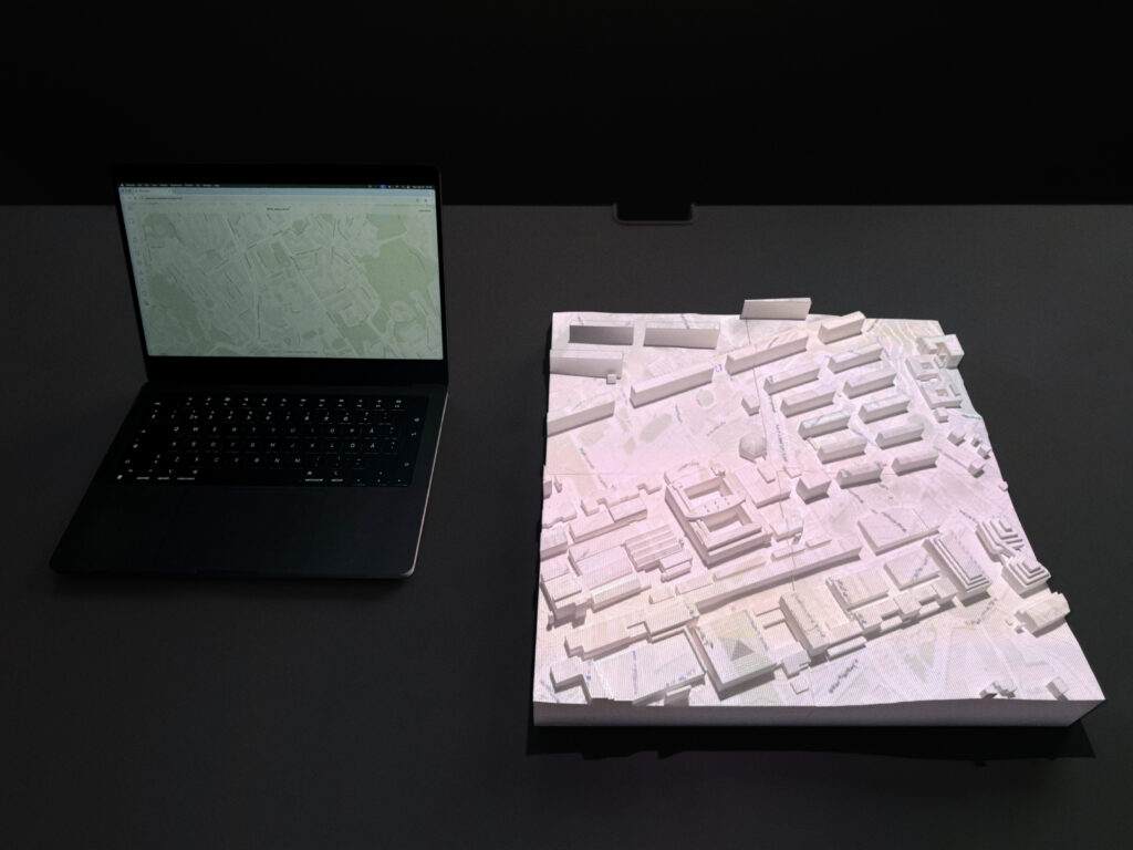
The Digital Twin Lab is a hands-on environment for making urban digital twins move off the screen and into physical space.
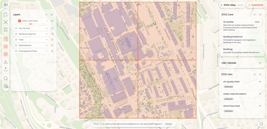
Simulation outputs and data produced within the DTCC software ecosystem land on a physical 3D-printed city model through calibrated overhead projection. The setup is designed to be deployable with low technical overhead, so partners and municipalities of any size can run sessions without specialist support. It is kept deliberately affordable and portable, so it works as well in a municipality meeting room as in a full exhibition installation. This makes the technology accessible to municipalities and communities that would otherwise be left outside these conversations.
Instead of staying locked inside specialist GIS and simulation software, georeferenced results become something people can gather around, point at, and discuss. This matters because the value of a digital twin depends on who can read it: researchers, planners, students, and the public rarely share the same tools or speak the same technical language, but they can share a table, and around this one, everyone arrives on equal footing.
Goal
The Lab has been progressively developed from an earlier research study into a system built for regular use, and current work continues to lower the barrier further. The goal is to turn geospatial and simulation results into a shared, tangible interface for research, public dialogue, and decision support. Making that interface easy to operate is an equally important part of the design; the lab should be accessible to any partner, not just those with technical infrastructure. Current development reflects this too: AI/ML-assisted autocalibration aligns the projection to the physical model automatically, replacing today’s manual corner-setting step. Planned voice commands with hand gesture integration will allow hands-free operation during the session, integrated with other DTCC software.
Outcome
For researchers, the lab is a way to inspect, validate, and explain models in spatial context. For the public, it turns complex urban data into something they can read, respond to, and speak back to, lowering the threshold for meaningful participation in decisions that affect their city. For planners and decision makers, it provides a shared visual reference, the city shown as both a physical model and a live data layer, to support discussion. The project is co-funded by DTCC (Vinnova Grant 2024-03904) and InfraVis L3 ticket “Bringing the City to Life – A Living, Interactive, and Physical Digital Twin”. Also, apart from the InfraVis application experts involved, the project has had significant help from Chalmers project assistants Nuri Sechkin and Ammar Kasem.
Keywords
Digital twin, tangible, multiphysics simulations, applied mathematics, UI/UX, 3D printing